
Weekend Feature
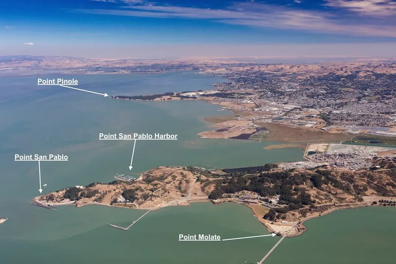
On five Saturday mornings this spring, small groups of Bay Area residents are getting a rare look at one of the bay's most overlooked places: Point San Pablo, a scenic headland at the northern tip of Richmond where San Francisco Bay meets San Pablo Bay, a place normally locked behind a gate and closed to the public.
The walks are organized by TRAC (Trails to Richmond Action Committee), the group that has spent 25 years working to complete the Bay Trail in Richmond. But the tours are about more than a trail. TRAC wants the city and East Bay Regional Park District to consider incorporating Terminal 4, the former industrial port that occupies the peninsula, into plans for a new regional shoreline park at the adjacent Point Molate site, with the Bay Trail as the link connecting the two areas all the way to Point San Pablo Harbor.
"The best and most efficient way to carry out park and open space plans for the Point San Pablo Peninsula would be to fold Point San Pablo into the planning for a Regional Shoreline at Point Molate," said Bruce Beyaert, TRAC chair, "with the SF Bay Trail linking the sites and extending to Point San Pablo Harbor."
The entrance is easy to miss, and almost nobody is looking for it. Past the Richmond-San Rafael Bridge, past Point Molate, there is a gate on the road that most drivers would only notice if they took a wrong turn or overshot the turnoff to Point San Pablo Harbor. On the other side of the gate is Good Hot, a sauna business. A little further, Terminal 4, and a history most residents have never heard of.
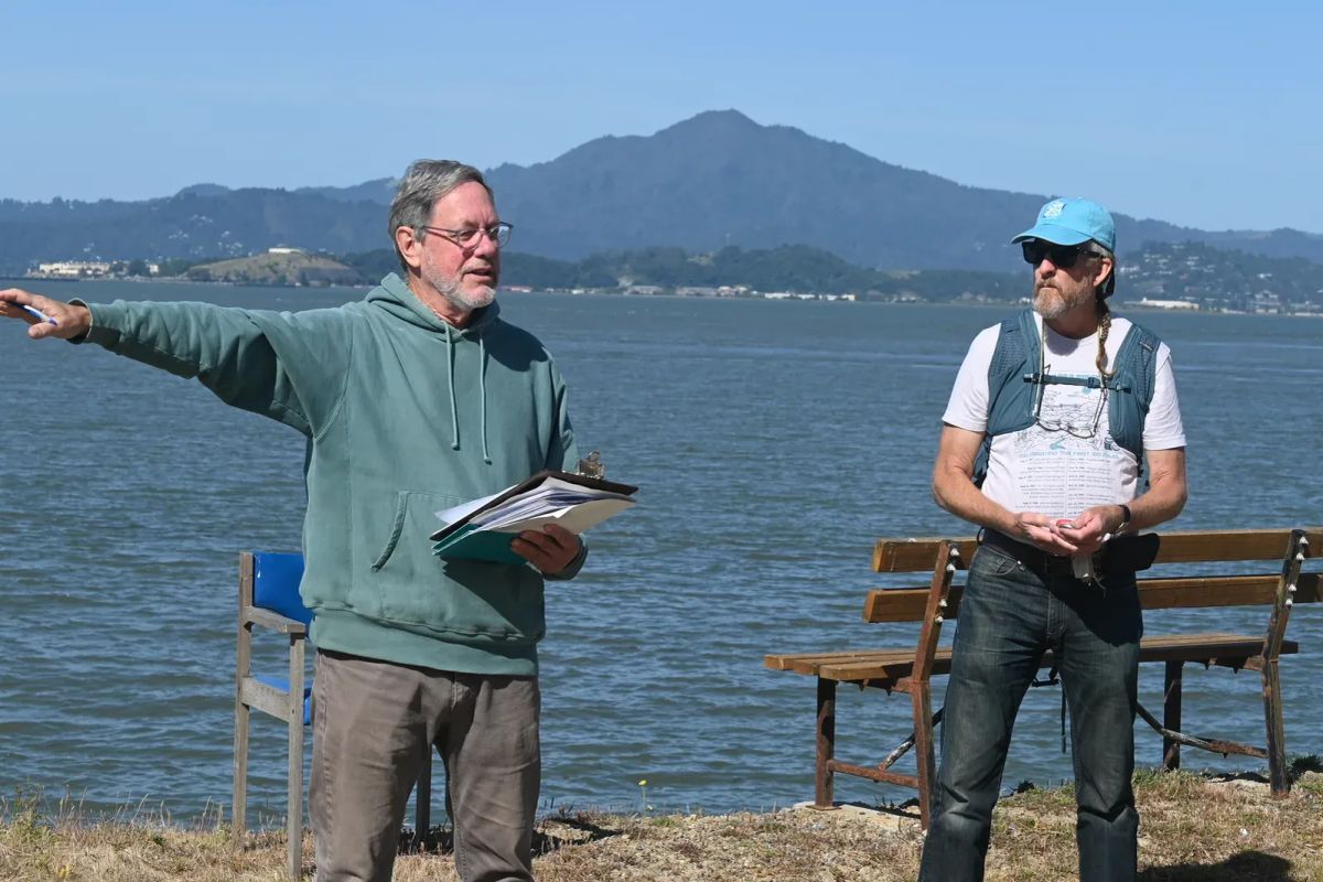
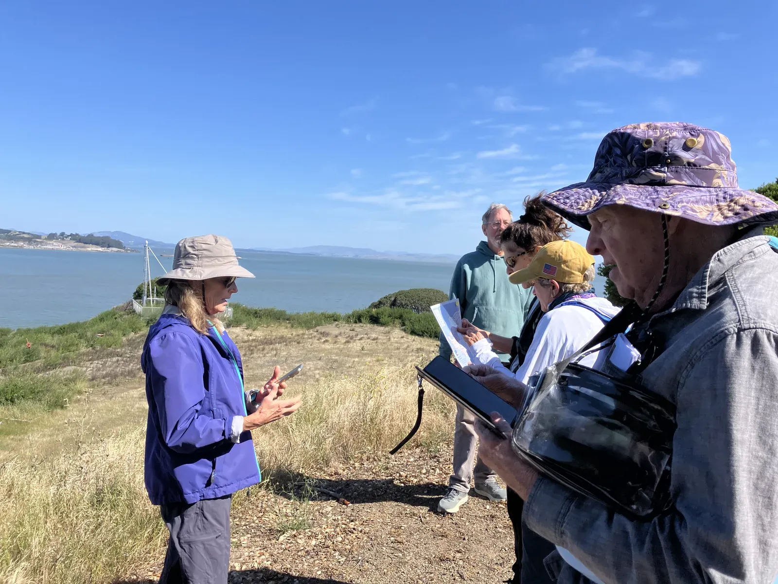
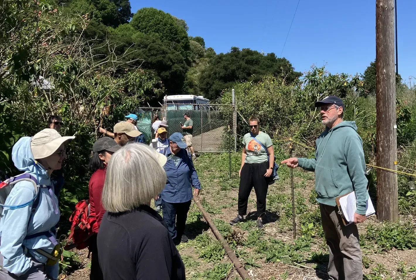
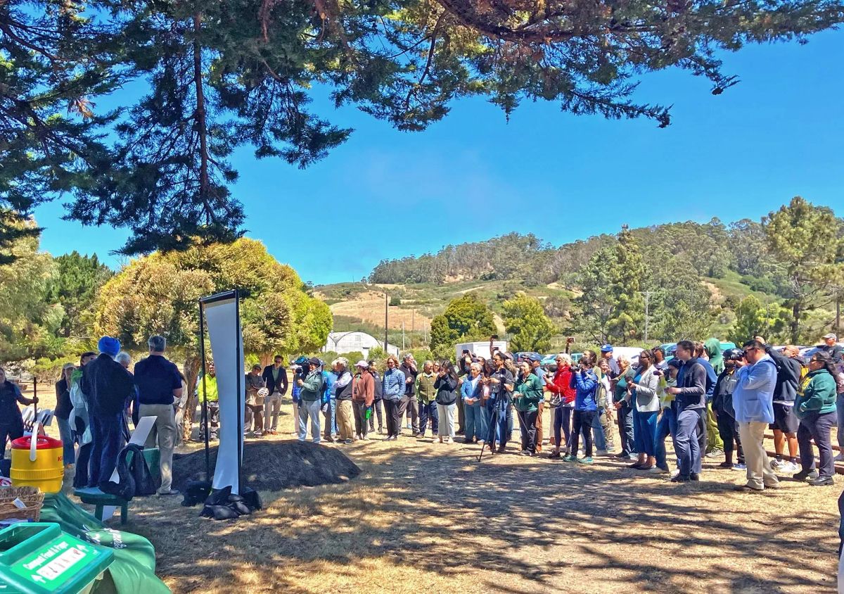
"The idea is to get people aware of this area, to get an understanding of what's here, what happened here in the past, and to think about what could happen here in the future," said TRAC Vice Chair Bruce Brubaker, addressing a group of about 20 participants at the start of one recent walk.
Point San Pablo, at the northern edge of Richmond’s shoreline, was once the city’s busiest and most diverse port. Its natural advantage came from a 115-foot-deep underwater canyon between the point and East Brother Island, carved during the last Ice Age and deep enough to accommodate large draft vessels.
"This is the deepest water of any port on the whole bay," Brubaker said. "No dredging necessary."
The East Shore Company recognized that advantage in 1903, building the Richmond Belt Line Railroad to link the transcontinental rail network with the headland and immediately constructing a wharf and warehouse. What followed was more than a century of overlapping industrial uses.
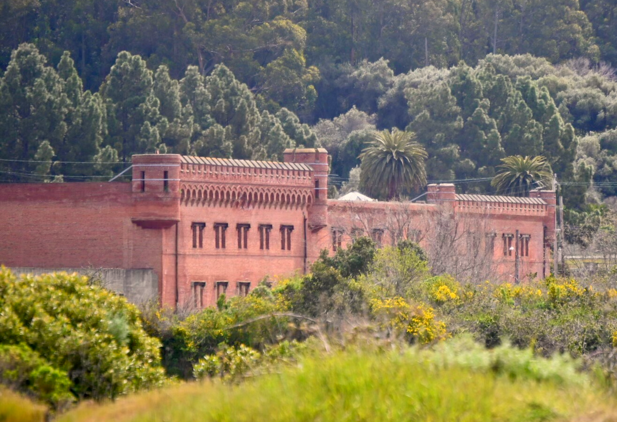
Wooden warehouses on the wharf shipped barrels of Winehaven wine and thousands of cases of Standard Oil kerosene to Asia and the South Sea Islands. Starting in 1917, Dorward Terminals imported coconut and tung oils from the Philippines for soap and paint manufacturers. In 1929, Pacific Molasses Company arrived with a contract for the entire molasses output of the Hawaiian Islands, an operation that ran for more than 60 years.
The boiler house from that era still stands on the property, now used as offices by Good Hot, one of the businesses on the site.
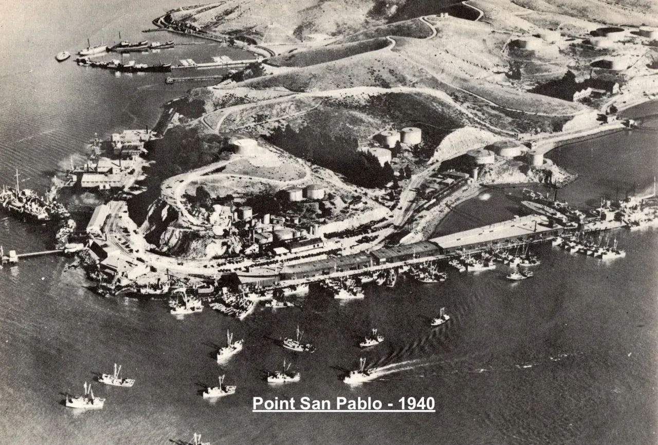
In 1937, Point San Pablo became home to one of the most concentrated fishing industry booms in Bay Area history. Twelve fish reduction plants were constructed within four months, employing upward of 500 workers processing sardines, herring, and other fish into high-protein meal and oil. The collapse of the sardine run in the late 1940s ended most of that industry, echoing the same fate that befell Cannery Row in Monterey.
The area also hosted what was, until 1971, the last operating whaling station in the United States. Beginning in 1956, crews of 40 men processed an average of 175 humpback, finback, and sperm whales annually, reducing a full whale to oil, poultry meal, and pet food in approximately 90 minutes. The station closed when federal law banned commercial whaling. It was later converted to a meat rendering plant and burned down in 1995.
Between the fishing and the whaling, the peninsula hosted a hotel and, during Prohibition, a notably lively roadhouse. Oral histories describe it as "an excellent restaurant. Wine, women, and song were available there in quantity. Very few sailors ever went any further than that particular point."
Today, Terminal 4 is owned by the City of Richmond and leased to a master tenant who subleases storage and limited industrial space to a handful of businesses. The area is closed to the public except for access to Good Hot and the nearby Point San Pablo Harbor marina.
Inside the gate, the walk through Terminal 4 is unlike anything else on the bay. Tour participants make their way up a road and trail past junked cars, RVs, a line of old school buses, and shipping containers, the accumulated debris.
One road climbs to a hilltop overlook with a panoramic view of San Francisco and San Pablo Bays that Brubaker says almost no one has ever seen. Eight islands are visible on a clear day.
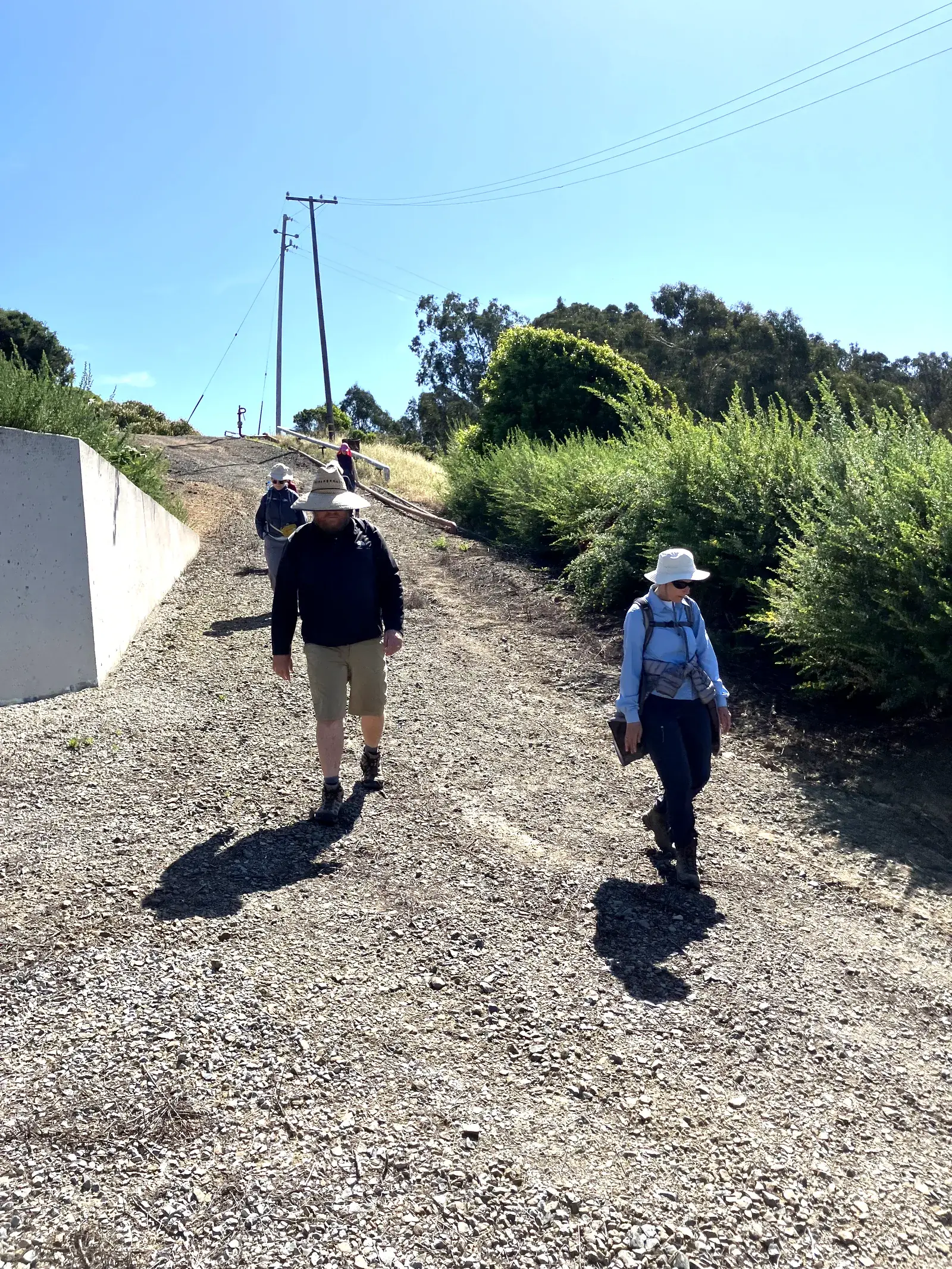
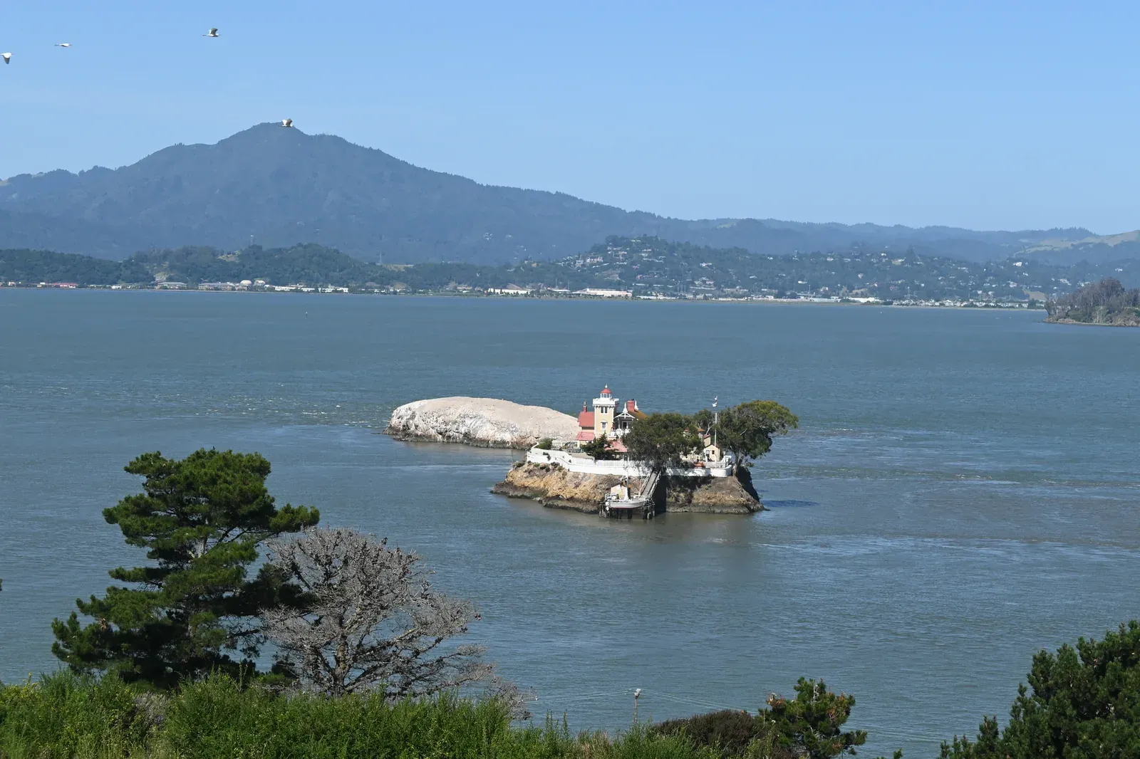
Participants climb the old port road to a hilltop overlook above San Pablo Strait, where East Brother Island lighthouse has marked the channel since 1873.
Along the way, the remains of a short-lived glamping and RV camping business sit idle, signage still up, Airstreams parked in place, the venture apparently shut down after a brief run on HipCamp. Brubaker noted that a fire department objection may have ended it.
A second locked gate marks Chevron property and the edge of Point San Pablo Yacht Harbor. The harbor is open to the public; you can reach it via this shoreline route or a narrow road over the ridge. Once there, it is its own world. The Sailing Goat puts on live music. There is a large-scale artwork, a houseboat community, and a bar. On busy nights, cars park in the overflow parking, which is accessible along the old rail corridor, and lights along the tracks help people find their way in the dark.
The trail toward the harbor passes through an unexpected wildness: blooming ornamental tobacco plants and stands of scotch broom line the path, giving the walk a slightly surreal, overgrown quality.
The huge Terminal 4 wharf, a hazard and environmental liability, was demolished by the city during 2024 and 2025 at a cost exceeding $9 million, funded by grants. The site has since been partially restored with native plantings and oyster reef balls placed in the bay.
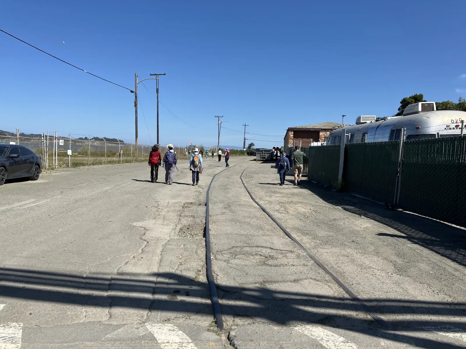
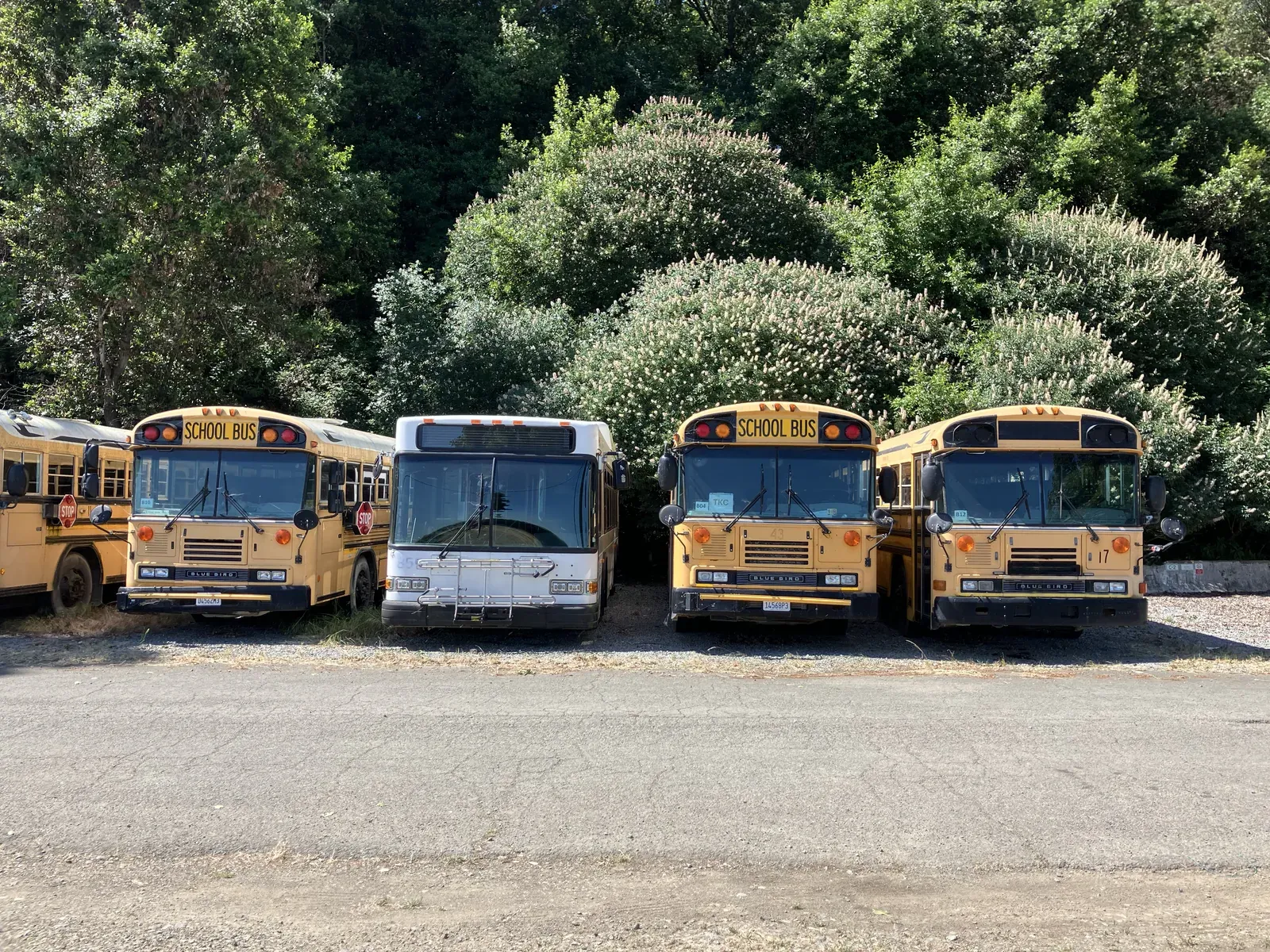
The interior of Terminal 4 today: shipping containers, old vehicles, and faded signage line the road through a former industrial port that once processed molasses, sardines, and whale oil.
As the lease deadline looms, the current master sublease expires in 2030. What happens next is undetermined.
"This lease is up in three and a half years," Brubaker told tour participants. "What happens after that is not determined."
TRAC was formed specifically to complete the Bay Trail in Richmond, and the peninsula is its biggest remaining gap. Richmond already has more completed Bay Trail mileage than any other city on the bay, including San Francisco, but a spur connecting the Richmond-San Rafael Bridge to Point San Pablo Harbor remains unbuilt.
The first half of that connection is underway. The East Bay Regional Park District is currently constructing a 2.5-mile Bay Trail segment from the bridge to Point Molate, including the historic Winehaven building, expected to open in 2027. The second half, through Terminal 4 to the harbor, is not yet planned or funded.
That is where the trail question and the park question converge. The East Bay Regional Park District recently acquired a large portion of Point Molate, including the historic Winehaven property, and is expected to begin planning a new shoreline regional park there. TRAC argues that Terminal 4 should be included in that process as well, using the Bay Trail as the link connecting Point Molate, Terminal 4, and Point San Pablo Harbor into one continuous stretch of public shoreline.
East Bay Regional Park District announces purchase of 82 acres at Point Molate
After decades of debate over the future of Point Molate, the East Bay Regional Park District has finalized the purchase of 82 acres of shoreline property on the Point San Pablo Peninsula, clearing the way for a new regional park. The $40 million deal, completed Tuesday, transfers the land from
"Should this be included in that planning effort?" Brubaker asked the group. "I think it's really important to do the planning before something happens here that wouldn't be good for the city."
A key obstacle to the trail is the old railroad right-of-way running through the peninsula. Union Pacific and BNSF (formerly Santa Fe) jointly own the 20-foot corridor, in places the only viable route for the trail. Chevron, which owns adjacent land, has granted easements for different portions of the Bay Trail near the Richmond Bridge. Getting the railroads to engage has been another matter.
Point Molate Bay Trail extension breaks ground in Richmond
Officials and community members gathered Friday at Point Molate Beach Park to celebrate the start of construction on a 2.5-mile extension of the San Francisco Bay Trail. The new segment will connect the park to the Richmond-San Rafael Bridge and include a 600-foot boardwalk, interpretive panels on cultural and
"You have to kind of drag them into court to get them to pay attention," Brubaker said.
TRAC is conducting several tours of the peninsula, limited to about 20 participants each, as part of an effort to generate public support for incorporating Terminal 4 into regional park and Bay Trail planning.
YOU GET MORE WITH A PAID SUBSCRIPTION
Your subscription enables Grandview Independent to deliver more:
- More time devoted to in-depth reporting
- Longer, more comprehensive stories
- Greater coverage of what matters to our community
Quality journalism costs money. Subscriptions allow us to keep reporting the stories that matter, without paywalls getting in the way of critical community information.
CLICK HERE TO SUBSCRIBE - Starting at just $10/month
FOLLOW US FOR BREAKING NEWS:
• Twitter: @GrandviewIndy
• Instagram: @GrandviewIndependent
• Facebook: @Grandview Independent
Copyright © 2026 Grandview Independent, all rights reserved.
Members Discussion