
News
A proposal to close the Richmond-San Rafael Bridge bicycle and pedestrian trail four days a week will face a final vote on August 7 at the Bay Conservation and Development Commission.
The commission postponed a similar vote in April after staff recommended against the closure, saying the plan didn’t meet the requirements for “maximum feasible public access” to the Bay Trail.
Public records obtained by Bike East Bay showed that BCDC staff had prepared a draft recommendation to keep the trail open around the clock. Facing a likely defeat, Bike East Bay said the Metropolitan Transportation Commission and California Department of Transportation withdrew the item.
“The Commission finds that reducing the availability of public access for the modified pilot, as proposed, is not warranted at this time,” the draft recommendation stated. It also said the plan “does not constitute maximum feasible public access.”
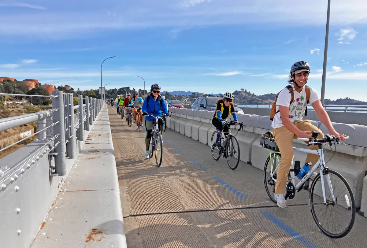
Transportation officials have resubmitted the proposal with what they describe as significant updates to address earlier objections. The revised plan would close the 4-mile trail on the bridge’s upper westbound deck from Monday to Thursday mornings, converting it into an emergency shoulder for vehicles. The trail would stay open from Thursday afternoon through Sunday night, and a free shuttle would operate during the closure periods.
In a letter to BCDC dated July 7, Muthanna Omran, Caltrans Regional Project Manager for District 4, defended the proposal as a "balanced solution that supports both traffic safety and public access."
“This schedule allows the shoulder to operate half the time as a multi-use path and half the time as an emergency shoulder,” Omran wrote.
The modified schedule would remain in place through at least 2028 to “generate data needed to make informed decisions on how best to facilitate mobility in this multi-modal corridor.” Omran added that the data will help evaluate “how communities are affected in terms of both equity and impacts from the operation of the path and emergency shoulder.”
Omran also highlighted that Caltrans and the Bay Area Toll Authority are advancing separate projects to improve travel options and reduce reliance on single-occupancy vehicles in the corridor. These include the Richmond-San Rafael Forward initiative and the Westbound Improvement Project, which explores converting part of the bridge’s upper deck into a part-time HOV lane.
“The data generated by the proposed Path modifications will also influence the design and operation of these upcoming projects,” Omran said. "Caltrans and its partners have recommended that the Metropolitan Transportation Commission commit up to $10 million in active transportation funds for bicycle access improvements in Richmond."
However, trail advocates say the revised application contains misleading claims and repackages unrelated projects as mitigation for the loss of public access.
In a letter to BCDC, Bruce Beyaert, chair of the Trails for Richmond Action Committee (TRAC), argued that bike and pedestrian projects listed in the Caltrans application as compensatory improvements are either already completed or under construction, and not within Caltrans jurisdiction.
Beyaert noted that a $10 million voter-approved Regional Measure 3 allocation for two Richmond projects was secured years ago and is unrelated to the bridge trail decision.
"This voter-approved RM3 funding has nothing to do with closing the RSR Bridge Trail and can’t be considered as a quid pro quo," Beyaert said.
Beyaert also challenged Caltrans claims that weekday morning incident rates and response times have increased on the bridge since the trail opened. He pointed to findings in UC Berkeley's PATH study, which showed that the observed changes in incidents were not statistically significant and may simply reflect random variation. The same study concluded that there was no evidence to suggest the bike and pedestrian path had a negative impact on overall traffic safety.
Bike East Bay’s Advocacy Director, Robert Prinz, said the advocacy group’s review of the updated proposal revealed no meaningful changes that would meet the standard for “maximum feasible public access” to the Bay Trail.
“The project description indicates a separate $10 million allocation to other biking and walking projects in Richmond, with the implication that bridge access could be traded for them,” Prinz said. “We do want to see those other projects get built. However, we have confirmed that the funding allocation is not contingent on the bridge trail being closed. So Richmond will still have access to this funding regardless of how BCDC votes.”
Prinz said several funded and approved projects are already underway to ease bridge congestion, including an "open road tolling" system now under construction, a westbound HOV and transit lane on the I-580 approach to the bridge, and an upgrade to the Richmond Parkway interchange.
Richmond-San Rafael Forward
The Richmond-San Rafael (RSR) Forward is a suite of strategies to reduce congestion and improve options for traveling on and near the RSR Bridge.
The original pilot project, launched in phases between 2018 and 2019, converted bridge shoulders to allow bicycle traffic and add vehicle capacity during peak hours. A UC Berkeley study found that the eastbound shoulder conversion reduced congestion and cut travel times by up to 17 minutes. However, the westbound bike path reduced vehicle throughput and delayed incident response times during weekday mornings.
Transportation officials say the modified schedule strikes a balance between recreational use, which peaks on weekends, and traffic safety during weekday commutes. On summer Saturdays, weekend bicycle traffic averages 264 westbound and 219 eastbound trips, compared to 75 westbound and 66 eastbound trips on weekdays, according to the PATH study.
The commission had scheduled votes for March 20 and April 3 but canceled both meetings on short notice after staff recommended against the closure. The cancellations frustrated thousands of supporters who had signed petitions and planned to attend.
The Bay Area Council has also attempted to rally supporters online with its Common Sense Transportation campaign.
Bay Area Council plans May 14 rally to push for reopening Richmond Bridge lane to cars
Regional business association, the Bay Area Council, has announced plans for a workers rally on Wednesday to reopen the third westbound lane on the Richmond-San Rafael Bridge to cars.
Common Sense Transportation said the new proposal aims to optimize the use of existing infrastructure with a flexible approach to traffic flow. The application also details plans for a part-time westbound carpool (HOV) lane, with an ongoing environmental review examining the potential addition of a third lane on the upper deck to further alleviate congestion.
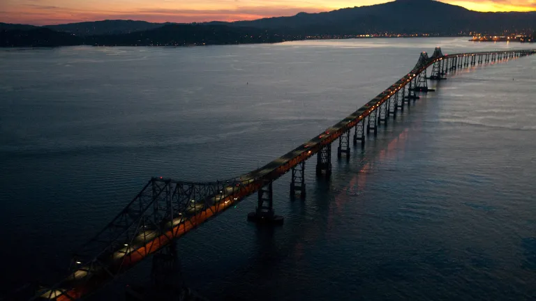
The 70-year-old Richmond-San Rafael Bridge is a key connection between Contra Costa and Marin counties on Interstate 580. The current pilot project authorization expires December 31, 2025. Transportation officials estimate the modified pilot would cost about $200,000 in capital and support costs and could operate for up to three years while environmental reviews proceed on other bridge improvements.
SUPPORT LOCAL JOURNALISM - SUBSCRIBE TODAY!
Grandview Independent needs your financial support to continue delivering the news that matters to our community. Quality journalism costs money, and we can't do it without readers like you.
SUBSCRIBE NOW and get:
• Unlimited access to all articles
• Newsletters with exclusive content
• The satisfaction of backing independent local news that serves your community
CLICK HERE TO SUBSCRIBE - Starting at just $10/month
FOLLOW US FOR BREAKING NEWS:
• Twitter: @GrandviewIndy
• Instagram: @GrandviewIndependent
• Facebook: @Grandview Independent
Copyright © 2025 Grandview Independent, all rights reserved.
Members Discussion