
News
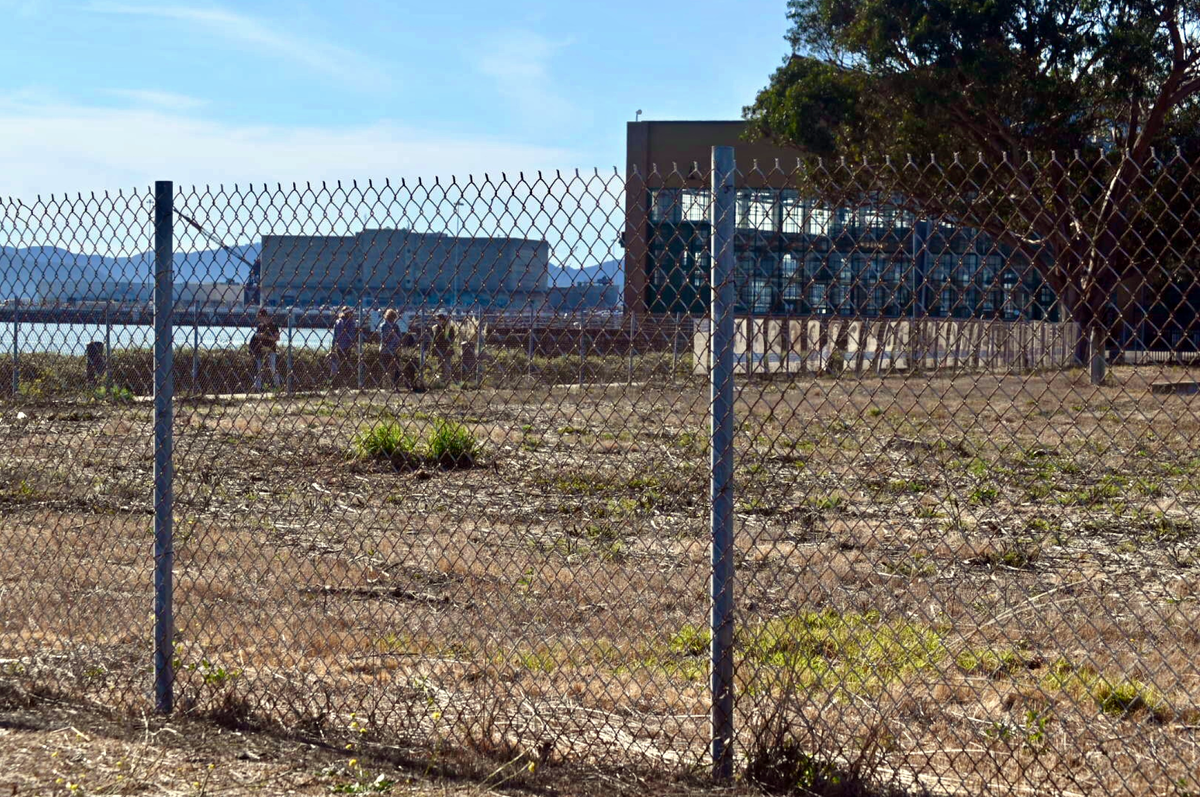
A proposed single-family housing development at a prime waterfront location near the Craneway Pavilion is facing criticism. The Marina Point project would create 100 housing units on a 4.92-acre vacant lot once part of the sprawling World War II Kaiser Shipyard. The property is zoned for very high-density residential and mixed-use and is designated as a major activity center in Richmond’s General Plan.
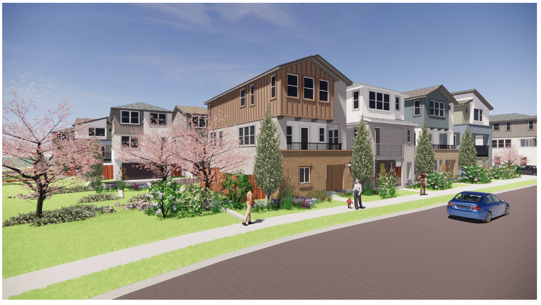
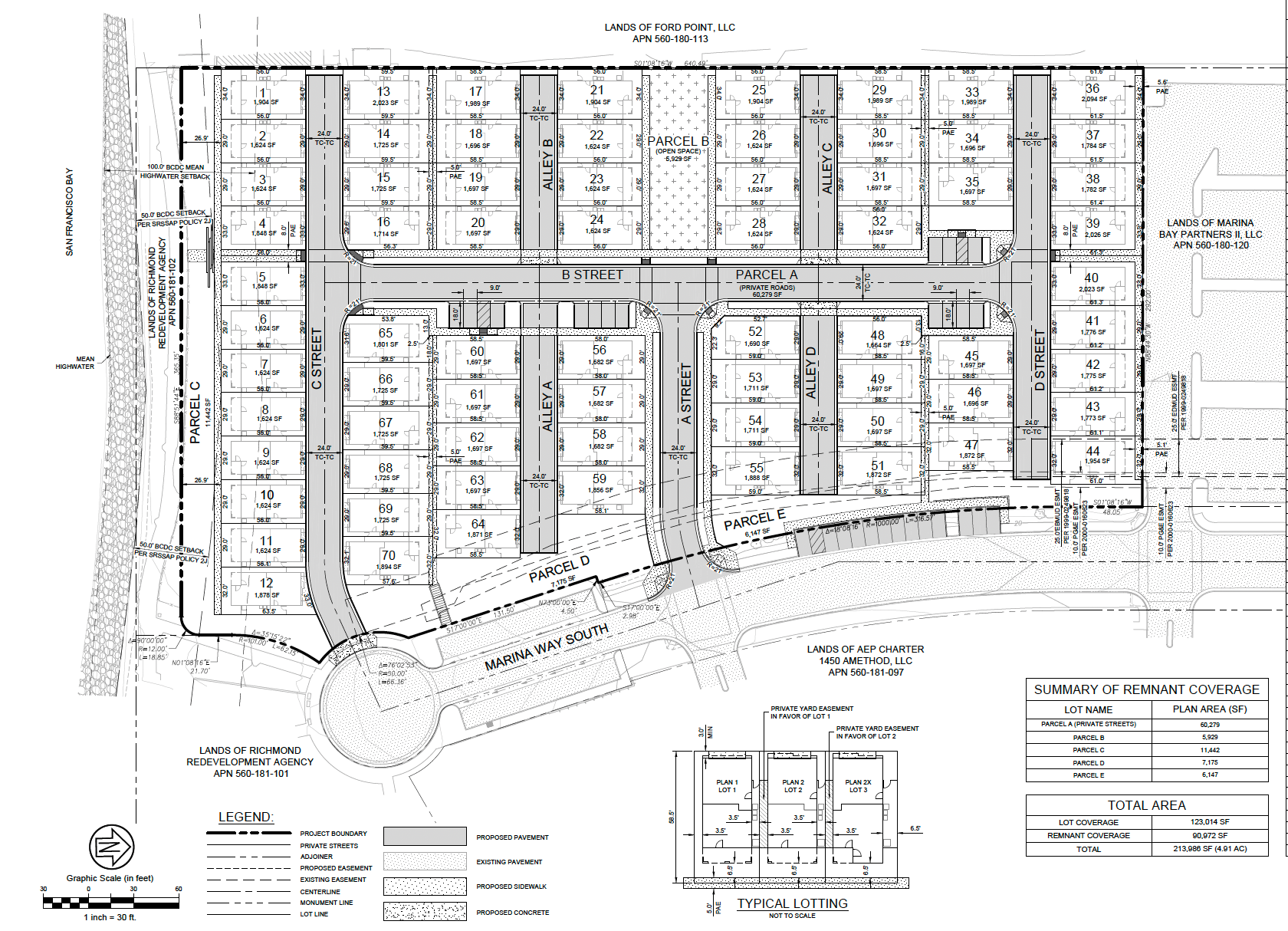
Southern California developer Guardian Capital has submitted plans to build 70 three-story single-family houses and 30 junior accessory dwelling units at the terminus of Marina Way South.
The property borders the San Francisco Bay Trail and waterfront and is located near the Ford Assembly Plant, Rosie the Riveter National Historical Park, and Lucretia Edwards Shoreline Park.
This area of Marina Bay was envisioned as a mixed-use waterfront district that would leverage San Francisco ferry service to serve the community, residents, and businesses in the Bay Area.
Richmond Planning Manager Hector Rojas said staff anticipated not recommending approval of that project because it is outside of the range of the density of the site.
“This site allows for that mixed-use, high intensity, high height,” Rojas said at a June planning commission meeting. “It is basically envisioning another type of project other than just single-family residential.”
The 20 units per acre called for in the submitted application is far below the 40 to 135 dwelling units per acre called for in the zoning for the property.
“Because it is one the premier sites in Marina Bay. Especially since it is adjacent to the ferry, it makes sense that because it has alternative transportation, this would be one of the higher-density projects in the city,” Rojas said.
In a letter accompanying the development application, Bryan Wenter, the developer’s attorney, stated the project is in accordance with the site’s zoning designation in the city’s general plan.
“Consistent with the High-Intensity Mixed-Use land use designation in the City’s General Plan applicable to the Project Site, Marina Point density will be approximately 16.1 units per net acre. This is consistent with the objective allowed density in Richmond General Plan 2030 of “up to” 125 units per acre,” Wenter wrote.
The Ford Motor Company once used the property to store military vehicles during World War II. After the war, it was mostly unused, but was utilized to store and repair metal shipping containers in the late 1980s. A large water tower was also located on the property at one time. The water tower, rail lines, and bridge structure were removed in the late 1980s, according to a geotechnical survey by Engeo Incorporated.
The site was reclaimed from the bay in the late 1920s by building a rock dike and filling the area between the dike and the existing land to the north. The top of the dike was 6 to 10 feet wide and was initially built to about 13 feet above sea level. The project site was filled with dredge spoils and topped with land-derived fill.
Trails for Richmond Action Committee Chair Bruce Beyaert said the project also fails to comply with Richmond’s Shoreline Overlay District ordinance, which prohibits non-water-related structures within a 100-foot tidal buffer.
“The currently proposed Marina Point Project has only a 50-foot setback from mean high tide. This places private residential properties only about 15 feet away from the existing concrete Bay Trail esplanade,” Beyaert wrote.
Beyaert said it was unfortunate that the developer spent so much time developing detailed plans, including lighting, utility, and stormwater control plans, before providing them for review and input from TRAC and other stakeholders.
“The applicant also appears to be unaware of plans by Trust for Public Land to complete the Richmond Wellness Trail along the Marina Way South frontage of the project,” Beyaert wrote.
Previous plans for the site envisioned a similar single-family residential project, "Richmond Riviera," comprised of 59 detached homes.
Richmond Riviera | Richmond, CA - Official Website
 Government Websites by CivicPlus®
Former mayor Tom Butt called the project Richmond Riviera 2.0, except ten times as ugly.
“It has single-family homes jammed-packed onto the site with almost no open space or amenities, and despite a world-class waterfront location, most homes only have a view of the house across the street,” Butt wrote in his newsletter. “It is truly discouraging that the worst developers in the country continue to bottom feed on Richmond and propose poorly designed, ugly projects that fly in the face of good urban planning.”
Help keep our content free for all!
Click to become a Grandview Supporter here. Grandview is an independent, journalist-run publication exclusively covering Richmond, CA. Copyright © 2023 Grandview Independent, all rights reserved.
Members Discussion